SF3D: Seismogenic Faults in three Dimensions
The Seismogenic Faults in three Dimensions (SF3D) is a compiled pilot dataset consisting of three-dimensional fault-geometry reconstructions natively designed for Earth's crust dimensions.
- Scope and Data: This initial pilot release includes crustal faults across diverse tectonic settings (active margins and stable continental regions) and environments (onshore, offshore, mountain belts, and foredeeps). It encompasses various faulting styles (normal, reverse, and transcurrent) that may slice through the ground surface, remain blind, or be buried beneath thick sedimentary cover. As a pilot study, it is designed as a foundational framework rather than a complete or exhaustive repository for immediate multi-context application.
- Key Features: All faults are modeled as triangular meshes generated via the specialized, custom-developed FaultStudio QGIS plugin. The dataset is distributed across three distinct mapping layers:
- A Master Table outlining the crustal fault mesh boundaries.
- A Meshes Table containing the individual triangular elements of the fault mesh.
- A Points Table archiving the raw input data points utilized to generate the models.
- Scientific & Practical Value:
- Repeatability: By providing the raw Points Table alongside the structured FaultStudio workflow, the dataset ensures that the creation of the Mesh Table can be perfectly reproduced by other researchers.
- Dynamic Updates: A core advantage of SF3D is its ability to perform seamless geometric updates. As fresh data emerges—even a single new data point—the workflow can be quickly rerun to regenerate an updated mesh without losing pre-existing information or requiring new arbitrary geological assumptions.
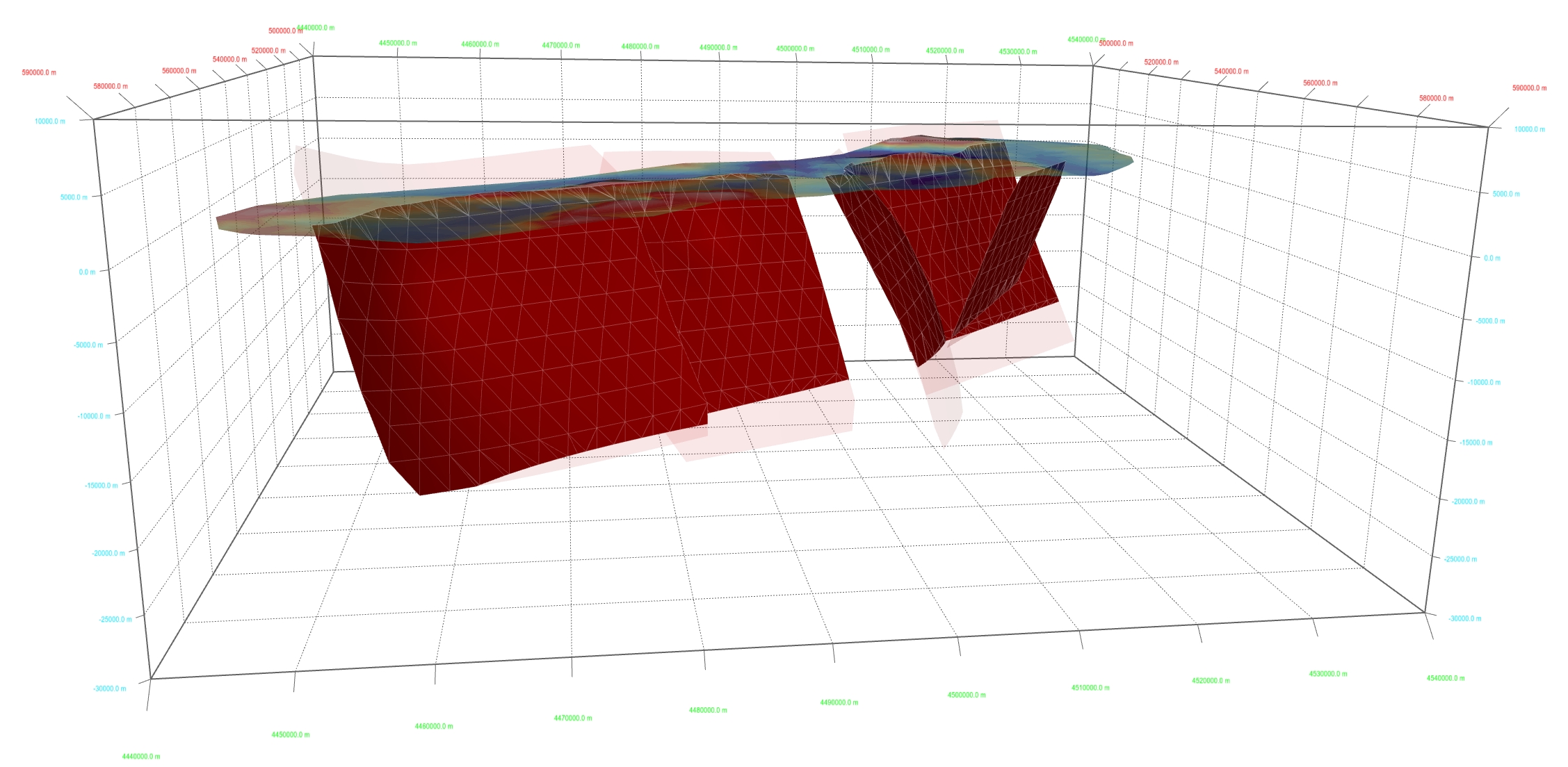
Oblique view of a 3D reconstruction of the Irpinia-Agri Fault System (southern Italy) from the South-East. The three fault segments in the northwestern sector are the source of the 23 November 1980, Mw 6.9, earthquake.