Database of Surface Faulting events in ITaly - SFIT
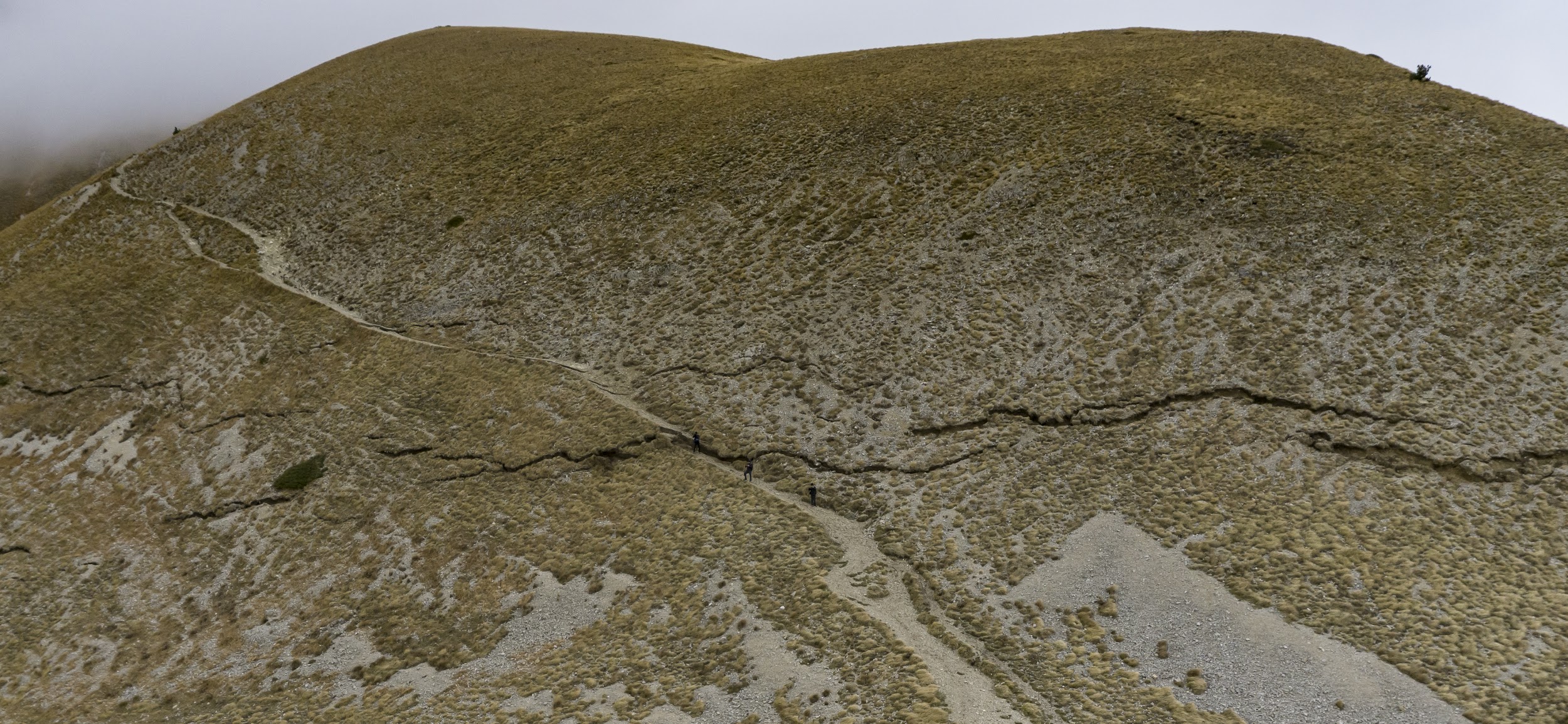
These rupture lines could be followed for a total extent of about 22 km. Credit: INGV.
The database of Surface Faulting events of Italy (SFIT) is a comprehensive compilation of published data on earthquake surface fault ruptures in Italy over the last century. The first release of the database documents six major events: the 1915 Avezzano (M7.0), 1980 Irpinia (M6.9), 1997 Umbria-Marche (M6.0), 2009 L’Aquila (M6.3), 2016 Norcia (M6.6), and 2018 Etna-Fleri (M5.0) earthquakes.
SFIT integrates, organizes, and harmonizes heterogeneous datasets derived from previously published compilations and scientific literature into a unified structure. All data included in the database are derived from previously published data sources. The database spans different tectonic environments and includes earthquakes with different magnitudes, rupture styles, and geological contexts.
Over the past decades, both the quantity and the resolution of available observations have increased significantly. While historical earthquakes inevitably carry greater spatial uncertainty, SFIT applies modern standards of data organization, image documentation, and georeferencing to ensure that these records remain scientifically robust and comparable through time.
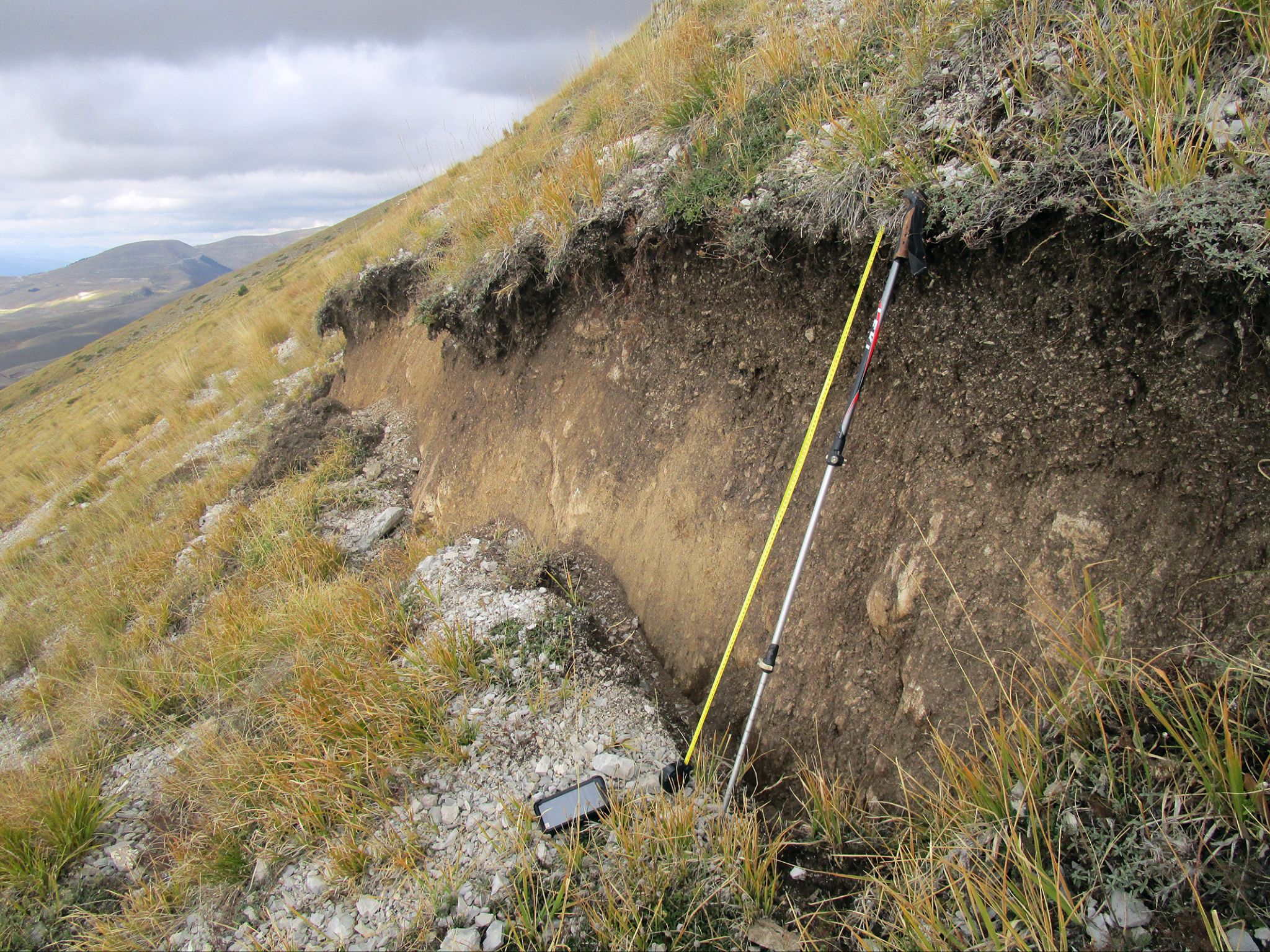
SFIT contains a wide range of information on points and traces of surface rupture collected in the field. The primary value of SFIT lies in its ability to centralize several data types within a single, searchable, open-access database. In addition, SFIT provides for the first time a collection of images, primarily photographic documentation, georeferenced and associated with the surface ruptures, representing a precious visual record of the observed deformation. The significance of mapped surface ruptures is classified following the original interpretation in the data source through a ranking code that systematically distinguishes principal ruptures from distributed, triggered, or ground-shaking-induced ruptures.
Principal coseismic surface ruptures represent the direct geomorphic expression of slip occurring along a fault during an earthquake (i.e. surface faulting). Their spatial distribution, geometry, kinematics and size provide a critical proxy for understanding the location, geometry, and kinematic behavior of the causative fault and the surrounding stress field. The systematic collection of coseismic surface rupture data is therefore essential for reconstructing earthquake rupture processes. For historical earthquakes that lack instrumental records, such observations can also be used to estimate earthquake magnitudes and to constrain the location and geometry of the causative fault. At the same time, coseismic fault displacement represents a localized source of hazard associated with surface-rupturing earthquakes, as it can directly affect settlements, infrastructure, and the landscape. By documenting the physical impact of surface faulting on both the natural environment and the built environment, SFIT provides an important resource for seismic hazard assessment and for improving the mitigation of risks associated with future surface-faulting earthquakes. The database can also be a reference for rapid scientific surveys during seismic emergencies, particularly for field teams operating on the ground, such as those involved in the long-standing Emergeo Working Group coordinated by INGV.
SFIT is designed as a living resource and will be progressively updated through new releases that incorporate additional events and datasets, ensuring its long-term value for both the scientific community and stakeholders involved in seismic risk management.
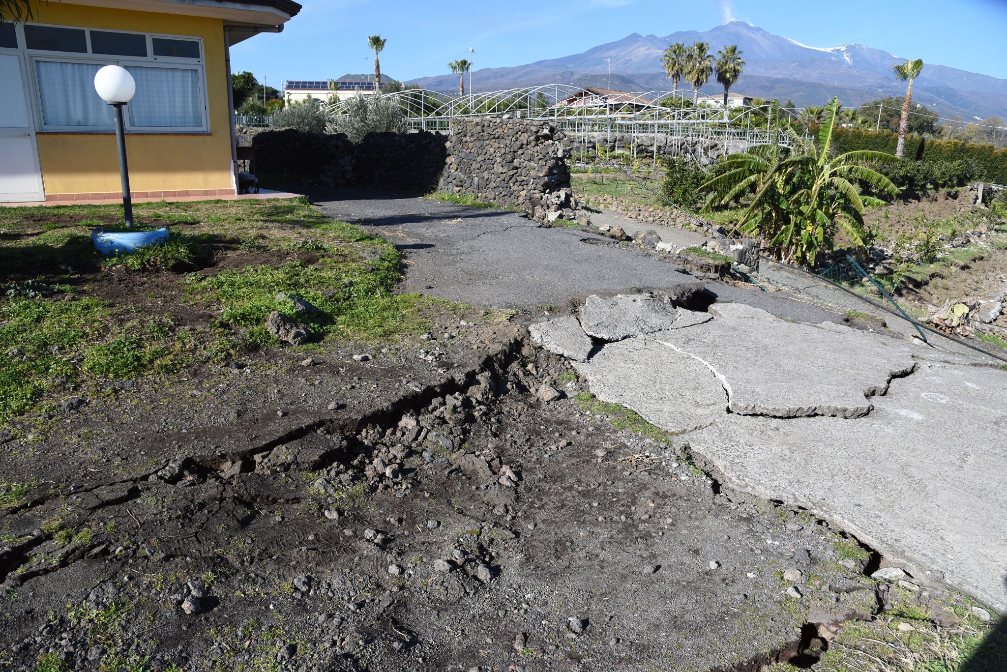
in the background. Credit: INGV.